(ABUJA 2025)
“GEO-SPATIAL INTELLIGENCE MAPPING FOR GOVERNANCE , POVERTY ALLIVIATION & SECURITY MANAGEMENT”.
ATTENTION, NEWLY
REGISTERED NCA MEMBERS!
AT LAST! YOUR MOMENT IS
HERE!
The *BIG DAY* is racing
towards you! Ignite your exclusive NCA membership.
Be prepared for a
*red-carpet reception* - *the NCA style* !.
Bring your energy; bring your passion as we welcome you into the
fold!
DATE: THURS, SEPT. 11th,
2025
Mark the date and Set the
alarms!
Don’t just watch the
future - CREATE IT!
Regards,
The National Secretary

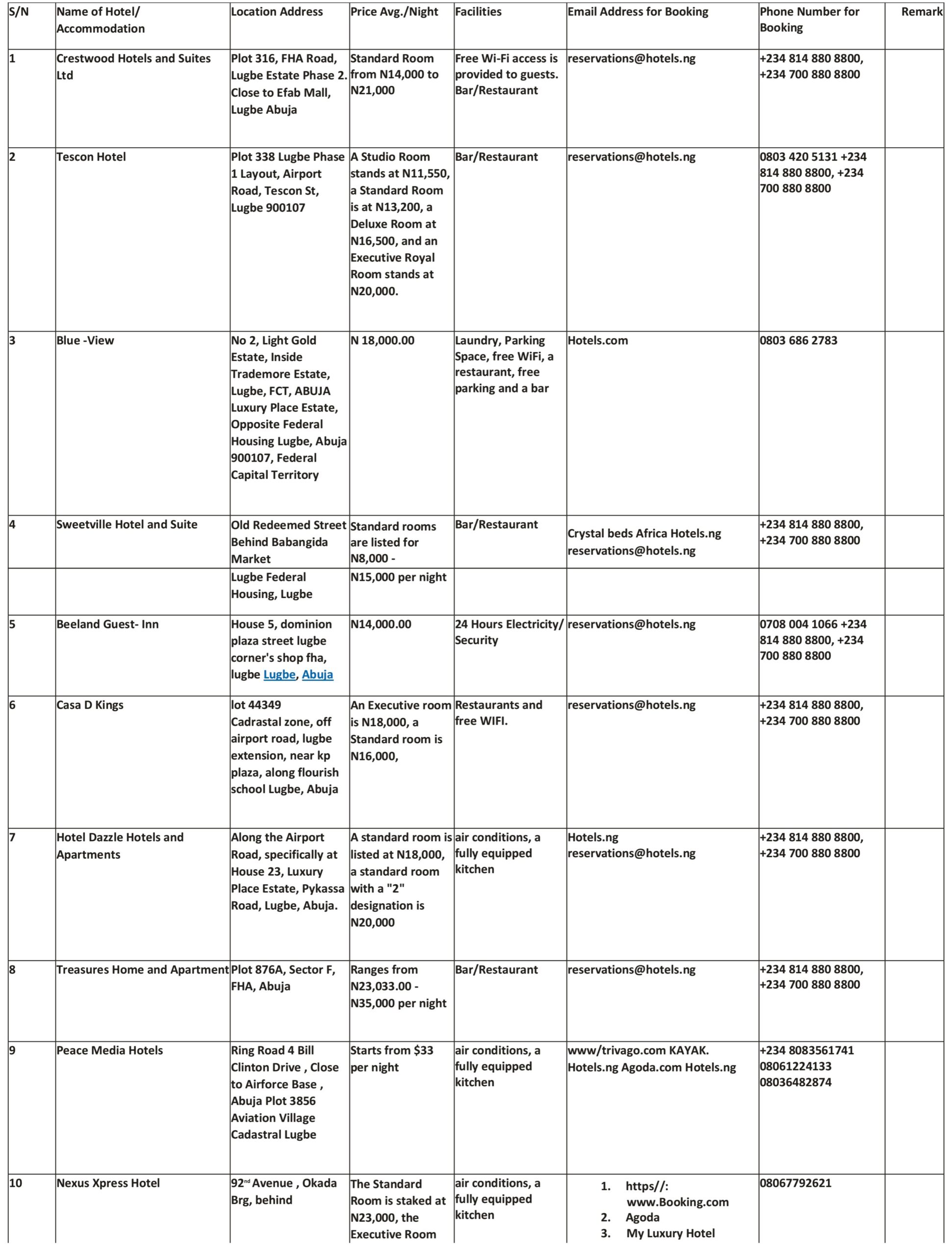
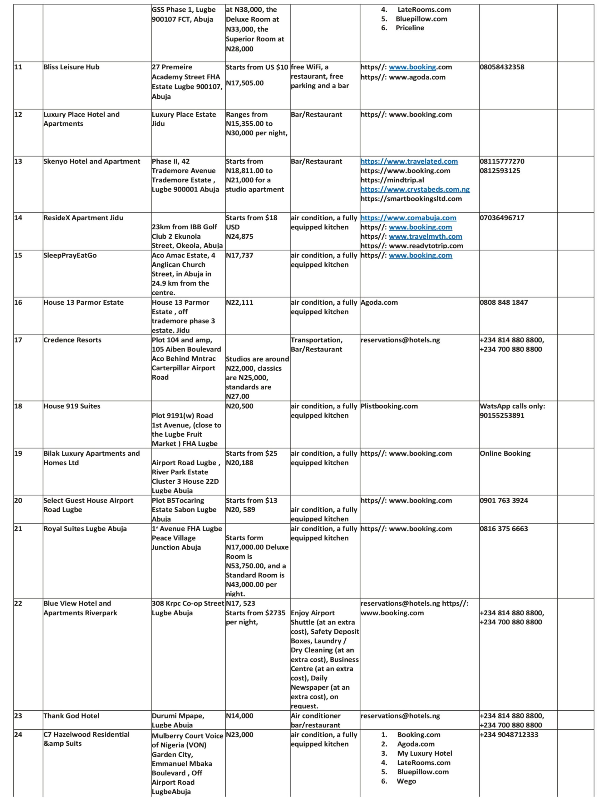
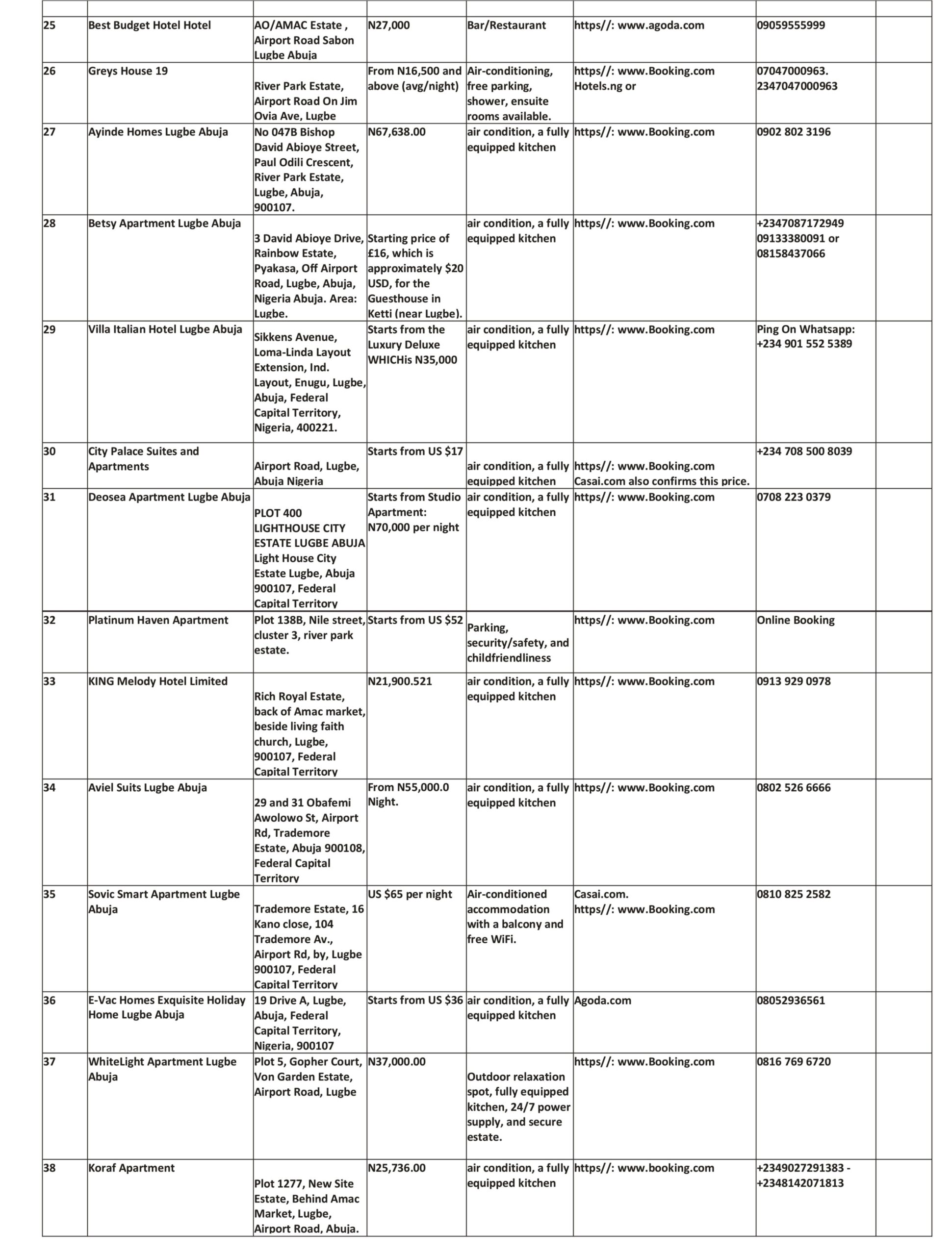
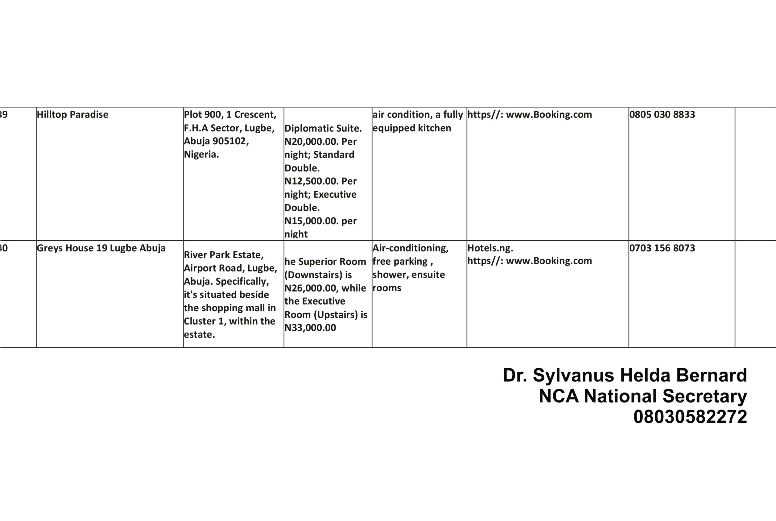
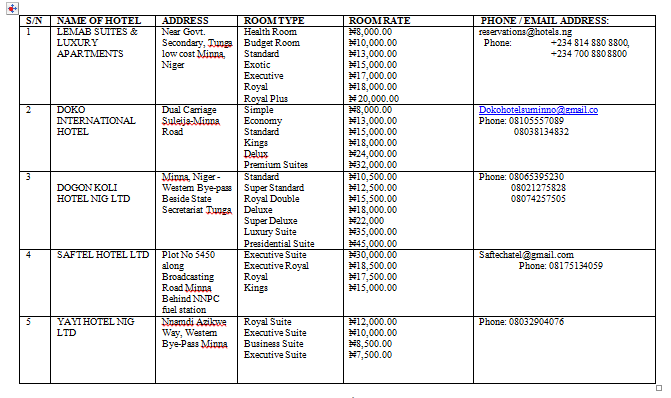
Available Hotels/Accommodation options during the Abuja 2025 conference
 ATTENTION! ATTENTION!! ATTENTION!!!
The NCA 2025 Conference/AGM Flyer is finally HERE !!!!! 
Dear NCA Members and Space Science Trailblazers!!
The wait is OVER!
The official flyer for the NCA 2025 Annual Conference & AGM - hosted in partnership with NASRDA Abuja - is finally OUT!!!
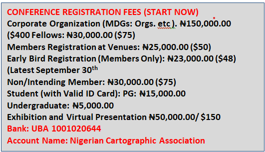
Download and share, tag peers and secure your spot NOW by taking advantage of the Early Bird Registration and sending an Abstract/Full Paper.
Let’s make Abuja 2025 Conference /AGM a memorable event to remember!  .
. 
Regards,
Dr. Sylvanus Helda Bernard
Secretary-General, NCA, Nigeria.


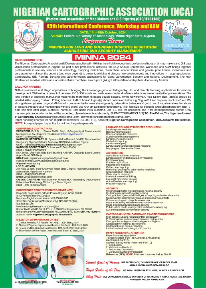
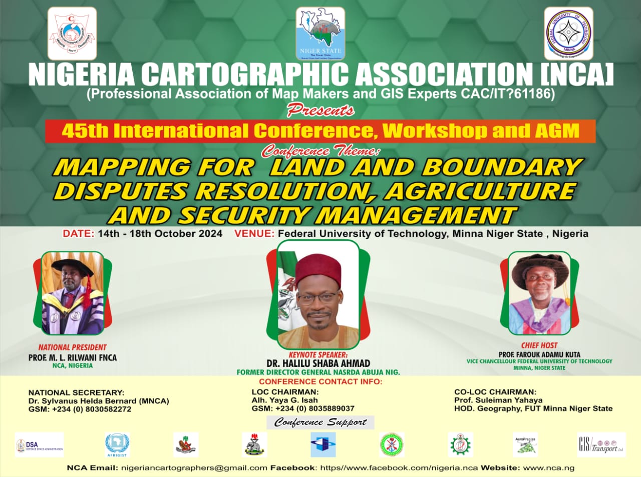
“MAPPING FOR LAND AND BOUNDARY DISPUTES RESOLUTION, AGRICULTURE AND SECURITY MANAGEMENT”.
Background Information
The Nigerian Cartographic Association (NCA) was established in 1978 as the officially recognized professional body of all map makers and GIS data
visualisation professionals in Nigeria. As part of her professional activities, the NCA organizes Annual Conferences, Workshops and AGM that bring together experts, scientists,
researchers, academicians and general practitioners (individuals and corporate) from all over the country (and beyond) to present, exhibit and discuss new developments and
innovations in mapping sciences and technologies with focus on Cartography, GIS, Remote Sensing and Geoinformatics applications for Good Governance, Security and National
Development. The 45th Conference activities will include the Induction of new members, as well as Fellowship, Merit/Honourary Awards to members,
individuals/corporate bodies.
Call For Papers
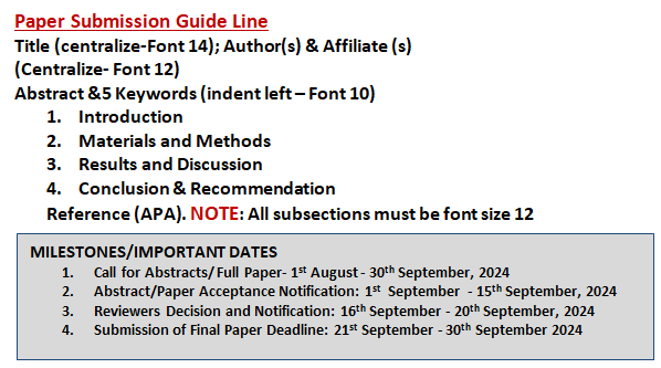
NCA is interested in strategic approaches to bridging the knowledge gaps in Cartography, GIS and Remote Sensing applications for national
development. Well written abstract of between 250 & 300 words and well-researched and referenced articles are requested for presentations. The long
version of accepted manuscript must not be more than 15 pages double spaced, Times New Roman, Pica 12 font size. Table(s) should be labeled at the top
e.g., “Table 1. Polling booths in AMAC, Abuja”, while Figure(s) should be labeled below e.g., “Figure Land Disputes Resolution”, etc. We strongly lay
emphases on good MAP(s) with proper embellishments having clarity, orientation, balance and good use of visual variables. There should be no abuse of
colours. Manuscripts should be prepared with MS-Word, using APA 6th Edition for referencing. Title: font size 13, sections and subsections: font size
12-bold and first letter caps. Author(s) name(s): First name-initial-surname, use 1, 2, etc. for affiliations and * for correspondence author. Only
manuscripts properly formatted will be accepted, please take note and comply. ARTICLE(S) should be sumitted TO: The Editor, The Nigerian
Journal of Cartography & GIS: ncacargisjournal@gmail.com, copy nigeriancartographers@gmail.com. Paper handling charges for non-registered
members is N5,000; ($10) , Account: Nigerian Cartographic Association, UBA Account: 1001020644. NOTE: Accepted paper for publication will be charged separately.
Sub-themes
Some Available Hotels/Accommodation Facilities around the Conference Venue
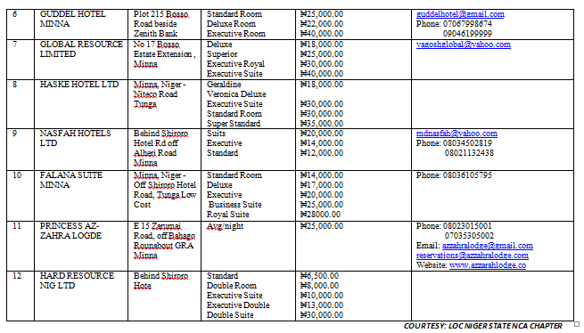
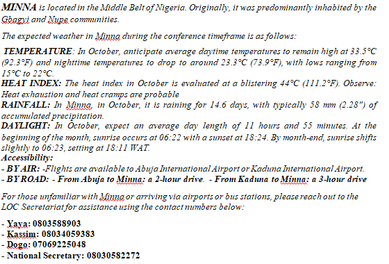
Snippets of Minna, Niger State: The Host State of Minna 2024 NCA International Conference
